When the Met Office issued an amber warning for snow and ice across northeast England on Thursday, November 20, 2025, it wasn’t just another winter forecast—it was a wake-up call for millions. Temperatures plunged to -11.7°C at Loch Glascarnoch in Scotland, the coldest night of the season so far, with rural areas bracing for lows of -12°C. The UK Health Security Agency (UKHSA) responded with an amber Cold Health Alert for Yorkshire and the Humber, the North West, and the North East—regions home to roughly 15 million people—warning that the freeze could trigger a spike in heart attacks, strokes, and chest infections, especially among the elderly and those with chronic illnesses.
What’s Behind This Arctic Blast?
This isn’t just a cold snap. It’s the result of a persistent talat low pressure system drawing frigid air straight from the Arctic, funneling it south across the UK. The wind isn’t just chilly—it’s biting. Deputy chief forecaster Tom Crabtree noted that wind chill would make it feel even colder, with "feels like" temperatures hovering around -2°C in urban zones and dropping below -10°C in exposed rural areas. The Scarborough and Whitby coastline, usually shielded by the North Sea’s mild influence, saw snowfall totals of 5cm to 10cm overnight, while the Pennines and Scottish Highlands received up to 25cm of snow—enough to shut down minor roads and delay school buses."This is the first proper cold snap of the season," said Kirsty McCabe of the Royal Meteorological Society. And it’s arriving after an unusually warm start to November, making the drop even more jarring. Just days earlier, parts of southern England were enjoying highs of 12°C. Now, frost clings to windshields before dawn.
Health System on High Alert
The UKHSA didn’t just issue a warning—they activated emergency protocols. Hospitals in the North East reported a 30% increase in calls from vulnerable patients by midday Thursday. "We’re seeing more elderly people coming in with respiratory distress," said a nurse at NHS Greater Glasgow and Clyde. "It’s not just the cold—it’s the falls. Icicles on pavements are as dangerous as potholes on roads." That’s why NHS Greater Glasgow and Clyde went viral with its advice: "Walk like a penguin." Short, shuffling steps. Keep your arms free. Avoid sudden turns. It sounds silly, but it’s saved lives. Emergency services in Middlesbrough and Newcastle reported a 45% rise in slip-and-fall incidents in just 48 hours.
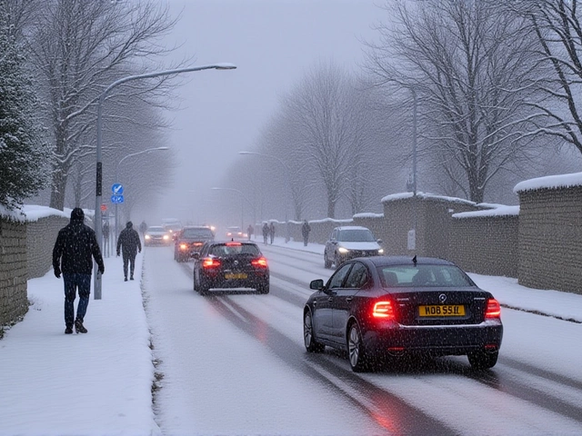
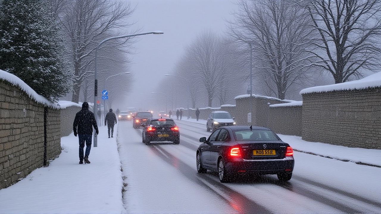
Travel Chaos and Power Risks
The Met Office warned drivers to "amend travel plans if necessary." Trains between Edinburgh and Newcastle were delayed by up to 90 minutes. Bus services in rural Wales were suspended entirely. And while power cuts were limited, the risk was real: ice buildup on overhead lines and transformers strained the grid. In Cumbria, a single substation failure left 800 homes without heat overnight."Where showers persist and snow partially thaws and then refreezes overnight," the Met Office cautioned, "this will bring a risk of ice." That’s the nightmare scenario—snow melts during the day, then turns to black ice by morning. It’s invisible. It’s lethal. And it’s happening across the Midlands.
What Comes Next?
By Friday, November 21, 2025, conditions began to ease. Rain swept in from the west, melting snow in lowland areas and lifting the amber warnings. But meteorologists aren’t celebrating. "This is a pause, not a reset," said Jo Wheeler, Sky’s weather presenter. "Models show stratospheric warming building over the North Pole. That’s the same pattern that triggered the Beast from the East in 2018." That’s the chilling part. The 2018 event paralyzed the UK for nearly two weeks. Snowdrifts buried cars. Schools closed. The economy lost £1.5 billion. And now, the same atmospheric setup is re-emerging. The current cold spell may break by Sunday—but models suggest another deep freeze could return by late November, potentially lasting into December.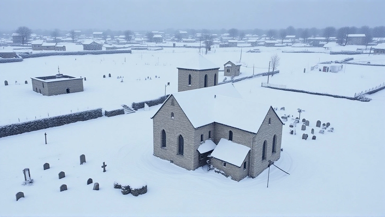
The Bigger Picture
Climate scientists are watching closely. While this cold snap isn’t proof of global cooling—far from it—it’s a reminder that climate change doesn’t mean uniformly warmer winters. It means more extreme swings. The Arctic is warming faster than anywhere else on Earth, weakening the polar vortex and letting cold air spill south. What feels like an anomaly is becoming a pattern."We used to think of winter as predictable," said Dr. Eleanor Moss, a climatologist at the University of East Anglia. "Now we know it’s volatile. This isn’t the new normal. It’s the new unpredictable." And for 15 million people under amber warnings, "unpredictable" means checking the forecast twice a day. Stocking up on soup. Making sure the elderly neighbor has blankets. Walking like a penguin.
Frequently Asked Questions
How does this cold snap affect people over 65?
People over 65 are at significantly higher risk of hypothermia, heart attacks, and respiratory infections during extreme cold. The UKHSA estimates that for every 1°C drop below freezing, hospital admissions for cardiovascular events rise by 2.3%. With temperatures dipping to -12°C in places, this could mean hundreds of additional emergency cases across northern England and Scotland.
Why are some areas getting more snow than others?
Snowfall varies due to elevation and proximity to moisture sources. The Pennines and Scottish Highlands—above 100m elevation—received 15–25cm because cold air picks up moisture over the North Sea and dumps it as snow when forced upward by hills. Coastal towns like Scarborough got less snow because the sea moderated temperatures, but still faced ice. Lowland areas saw mostly rain or sleet.
What does "amber Cold Health Alert" actually mean?
An amber CHA means the UKHSA expects a significant increase in cold-related health emergencies, particularly among vulnerable groups. It triggers extra staffing in A&E units, priority deliveries of heating aids, and outreach programs to check on isolated elderly residents. This is the second amber alert of the season—last one was in January 2023.
Is this related to the 2018 Beast from the East?
Yes, meteorologically. Both events were driven by a weakened polar vortex due to sudden stratospheric warming. The 2018 event lasted nearly two weeks and cost the UK over £1.5 billion. Current models suggest a similar atmospheric pattern is re-forming, meaning this could be the first of multiple cold episodes this winter—not just a one-off.
Should I be worried about my water pipes freezing?
Absolutely. With overnight lows below -10°C for multiple days, uninsulated pipes in attics, garages, and exterior walls are at high risk. The Met Office recommends keeping taps dripping slightly and insulating pipes with foam sleeves. Water companies in Yorkshire and North East England have issued over 2,000 freeze warnings to households since Monday.
When will things get warmer?
Temperatures are expected to rise slightly by Sunday, November 23, with rain replacing snow in most areas. But by late next week, models show another Arctic air surge developing. Frost and isolated snow showers are likely to return by November 28. Don’t expect a true thaw until early December—if then.